Among the invited speakers and plenary participants are Jerome Dobson, president of the American Geographical Society, Miguel Aguilar Robledo, geographer from the Universidad Autonoma de San Luis Potosi, Peter Herlihy, from the Department of Geography at Kansas University, and Lieutenant Colonel Geoff Demarest, of the U.S. Army Foreign Military Studies Office. In 2005, the aforementioned individuals and their respective institutions collaborated in the mapping of communally owned indigenous territory in Mexico. The mapping was conducted without informing the local communities that there was military funding behind the project.
The 2011 World Human Geography Conference: Communities and Ethics is scheduled for September 15th and 16th, 2011 in Lawrence, Kansas. The conference will be hosted by the American Geographical Society, Haskell Indian Nations University, Kansas University, and the U.S. Army Research Office, based in Fort Leavenworth, Kansas.
The conference has two themes:
Theme One: field-based knowledge about foreign people and places.
Geographers, anthropologists, and other regional experts will highlight what they have learned from years of field research enhanced by language skills, scholarship, and geographic information systems (GIS).
Theme Two: communities and ethics.
Speakers from a variety of communities – public, private, tribal, academic, and government institutions from local to global – will discuss community-based research methodologies; the ethics of funding sources; and the nature and accessibility of open-source research in the digital age, with a focus on how these themes impact indigenous peoples.
The Department of Geography at Kansas University received at least $500,000 in Department of Defense funds to map communally-held indigenous land in the Mexican states of San Luis Potosi and Oaxaca. With the help of the US Army’s Foreign Military Studies Office (FMSO), located at Fort Leavenworth in Leavenworth, Kansas geography professors Peter Herlihy and Jerome Dobson ploughed ahead with the “Mexico Indigena” project, a part of the larger mapping project, the Bowman Expeditions.
The FMSO researcher assigned to the Bowman Expeditions, Lt. Col. Geoffrey B. Demarest, is suspected of using the maps as military intelligence against indigenous communities that assert autonomy and self-determination through collectively governing and owning their territory. According to Demarest, the only path to ‘progress and security’ in Latin America is through the privatization of such types of communally-held land.
In FMSO publications and a textbook titled “Geoproperty: Foreign Affairs, National Security and Property Rights,” Demarest claims that “informally owned and unregulated land ownership favors illicit use and violence,” and that the only solution to these breeding grounds of crime and insurgency is the privatization and titling of the land.
Demarest was not only trained at the US Army School of the Americas—the facility famous for teaching torture and the creation of paramilitary death squads to Latin American military personnel—but also served as the US Military Attaché at the US Embassy in Guatemala between 1988 and 1991, a time of heavily US-backed military repression against indigenous communities in Guatemala and several high-profile cases of torture and murder.
Before his work on the “Mexico Indigena” project, Demarest was implementing his land data strategies in Colombia, at least up until 2003. A March 2003 FMSO essay written by Demarest titled “Mapping Colombia: Land Data and Strategy,” clearly states the ultimate use of the geographic data:
“While the forensic value of land ownership data is relatively obvious, not so obvious is the correlation between land data and military strategy, but this correlation precisely marks an essential attribute of successful counterinsurgent campaigns.”
In the same essay, Demarest takes it a step further and exposes the imperialistic intentions for land data and strategy:
“Strategic power becomes the ability to keep and acquire ownership rights around the world. National, sub-, supra- or transnational power can be measured accordingly.”
The FMSO’s primary mission is to assess asymmetric and emerging threats to the national security of the US. By asymmetric threats they mean guerrilla armies, and terrorist organizations. The FMSO is therefore evaluating indigenous-influenced-social movements as emerging threats to the security of US political and economic interests in Mexico.
Oliver Froehling, geographer and academic director of the Universidad de la Tierra (University of the Earth) in Oaxaca city, highlights the danger of these mapping projects when he states: “The Mexico Indigena project subscribes to a military/political strategy. We cannot forget that the mapping begins amidst talks for a US military funding packet known as the Merida Initiative. The control and displacement of indigenous communities intends to remove potential political hot spots, contribute to military control of the region, and ultimately ‘liberate’ natural resources for the benefit of the government and, in turn, its transnational allies.”
For the indigenous of southern Mexico, territory and culture are so intertwined in daily life that one without the other is like a bicycle with no wheels. Yet the ‘progress and prosperity’ of free trade inherently implies a loss of identity and tradition for indigenous communities. For indigenous communities in Mexico to claim their autonomy and territory is a deeply urgent reclamation of identity.
The implications of the Bowman Expeditions and the Demarest essays extend beyond indigenous lands, reverberating throughout all sectors of society, and in particular, the world’s urban poor. In a spring 1995 FMSO essay titled “Geopolitics and Urban Armed Conflict in Latin America,” Demarest criminalizes and warns against the potential of all Latin America’s urban poor:
“Moneyed interests in Latin America continue to isolate, physically and socially, the sprawling poor communities. The shantytowns become separately governed areas. They mark the physical dimensions of what in some ways are autonomous nations within nations. At some point their leadership may be seen as a national security threat as opposed to merely a public security threat. Therein lies their geopolitical importance.”
In a previous section of this same essay, Demarest lists anti-state actors who find a home among the world’s poor:
“Distinctive features of the largest or so-called ‘world cities,’ of which Latin America has several, include marked economic and social polarization and intense spatial segregation. We also find what is probably an effect of these conditions: the complementary agendas and overlapping identities of a large array of anti-state actors. Anarchists, criminals, the dispossessed, foreign meddlers, cynical opportunists, lunatics, revolutionaries, labor leaders, ethnic nationals, real estate speculators and others can all form alliances of convenience. They can also commit acts of violence and handle ideas that provoke others. These ideas may be as specific as resisting a rise in bus fares, as immediate as an opportunity for looting following a mass celebration, or as broad as ethnic identity.”
Like communally held indigenous land, unregulated shantytowns are considered precursors to crime and insurgency by the FMSO. In the US and cities around the world, the privatization of poor communities through gentrification is a similar multi-faceted strategy of marginalization through devaluation, criminalization, and displacement. To be poor and organize your community to survive by its own means, to exercise self-determination, according to the Demarest essays, is to be a threat to US political and economic interests, domestically and abroad.
The Mexico Indigena mappers have assured critics time and time again that they had the full support of the communities, which were mapped. Several other academics and community members have challenged this claim, and a series of official community authority documents rebuking the mapping project, have circulated the internet.
The 2011 World Human Geography Conference is intended to open a discussion about the ethics on these type of academic practices, supported by military initiatives. We are encouraging student and community participation in the conference on a massive scale in order to assure that a true balance is achieved during the conference.
Additional background info:
U.S. army’s geo-piracy in Oaxacan communities condemned
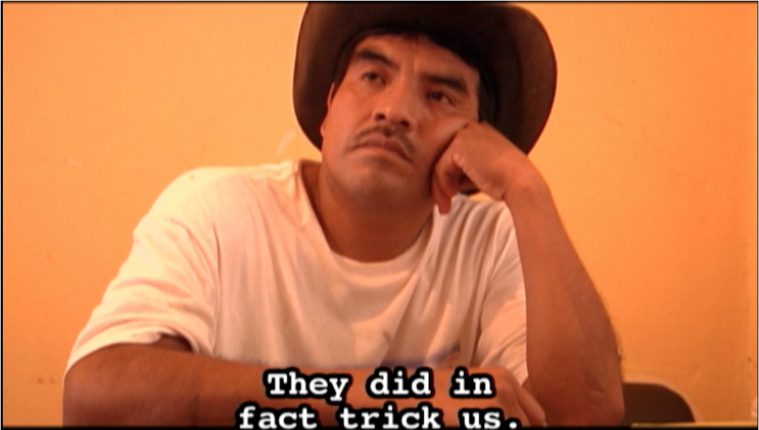
WATCH FEATURE FILM: “The Demarest Factor”


I was wondering when Factor Demerest would make el enemigocomun, great job bro!!!!